The Challenge
Ireland has thousands of ghost houses.
Nobody knows exactly where they all
are.
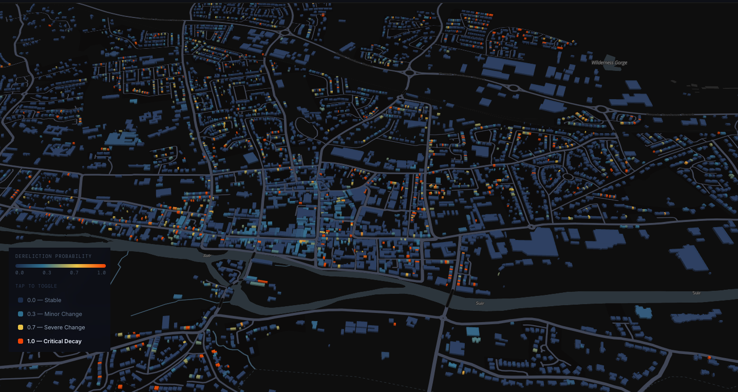
From boarded-up windows in Clonmel to ivy-swallowed terraces in the West, dereliction is everywhere — and yet the data to track it barely exists. Project Fothrach is changing that.
Loading intelligence report…
9,277+
Buildings profiled in the Clonmel pilot
6 yrs
of satellite history analysed per site
3
Independent sensor streams fused per building
What's Next
From orbital data
to action on the ground.
We're expanding the pilot beyond Clonmel and working with local authorities to put verified dereliction intelligence directly into the hands of housing teams.